Fast, affordable junk removal Staten Island services by GO4 Junk Removal. We handle all types of debris removal, furniture disposal, and more with eco-friendly solutions.
Or, just fill out this form and we’ll be in touch right away.
* Text a picture of what you need removed to (866) 464-5865 for a Free Quote!
Don’t have a huge budget?
That’s okay. You don’t need one.
Need it done fast? We’re your guys. Weekends, last minute, we’re ready.
Don’t like surprises? We don’t either. 100% transparent pricing.

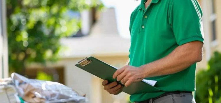
Welcome! We specialize in junk removal services in Staten Island.
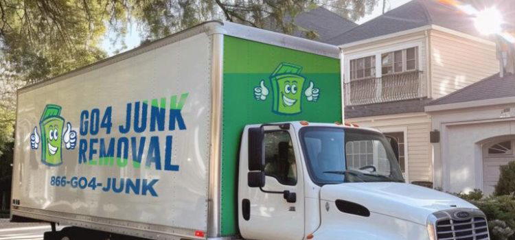
GO4 Junk Removal Staten Island has provided top rated junk removal services in Staten Island, New York for years. After years of pickups, hauling services, and removals for both residents and businesses, the GO4 Junk Removal name stands on its own.
We’re proud to have accrued a 4.9+ star average rating from hundreds of happy customers. We believe we’re the best local junk pros in Staten Island and we continue to work hard to retain that title!
To learn more about how we can help, call us at (866) 464-5865 or use our online form to get a free estimate and info for trusted junk removal or cleanouts.
Staten Island is the southernmost borough of New York City, coextensive with Richmond County and situated at the southernmost point of New York state. It is separated from New Jersey by the Arthur Kill and the Kill Van Kull, and from the rest of New York City by New York Bay.
The island’s strategic location at the center of New York Bight offers stunning views of the Manhattan skyline, the Statue of Liberty, and Ellis Island. Staten Island, NY is connected to Brooklyn by the Verrazzano-Narrows Bridge and to Manhattan via the iconic Staten Island Ferry, which provides free transportation for over 21 million passengers annually.
The borough is known for its diverse attractions, including the Historic Richmond Town, a restored rural settlement with 17th-century houses, and Fort Wadsworth, a Dutch-built fort from the colonial era. Staten Island’s North Shore, particularly neighborhoods like St. George and Stapleton, represents the most urban area, featuring the St. George Historic District with its Victorian architecture.
The island is also home to the Fresh Kills, once the largest landfill in the world and now undergoing transformation into a vast park. This transformation highlights Staten Island’s ongoing challenges in waste management and environmental conservation, as the borough strives to balance its growing population with its nickname as the “borough of parks,” boasting over 12,300 acres of protected parkland and more than 170 parks.
Staten Island, NY Zip Codes: 10301, 10302, 10303, 10304, 10305, 10306, 10307, 10308, 10309, 10310, 10311, 10312, 10313, 10314
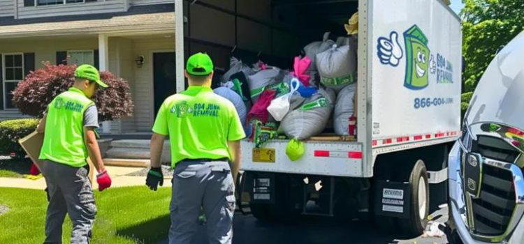
We’ve picked, hauled away, and properly disposed of 10,000+ items for 1,000+ customers over the years earning a 4.9 average rating. Our reputation speaks for itself, as do our customer reviews!
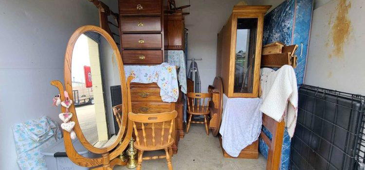


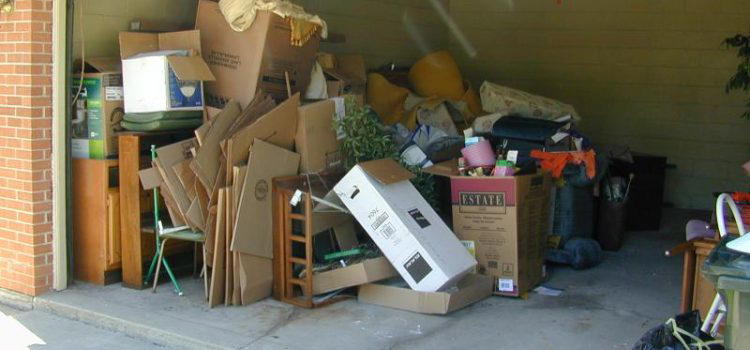
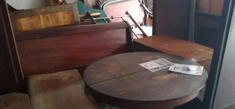


Getting rid of unwanted furniture in Staten Island is be a hard, tiring process. Furniture tends to be large, bulky, and heavy, making it difficult and sometimes even dangerous to move alone. The U.S. Consumer Product Safety Commission (CPSC) estimates approximately 19,400 people go to the emergency room every year for injuries related to moving furniture, televisions, and appliances. Inexperienced movers can easily injure themselves or cause damage to interiors while relocating it, too, which just creates new problems.
Disposing of a piece of furniture requires you to carry it outside, lift it into a truck, and then deliver it to a landfill. If you’re one of our conscientious customers wanting to avoid needlessly contributing to a landfill, you might even look for somewhere to donate it. That’s a lot of work. Sometimes the furniture will need to be disassembled or broken apart before it can be removed, too. That dramatically increases the time and effort to remove it. Most of the time you need multiple people in order to navigate it through your home as well.
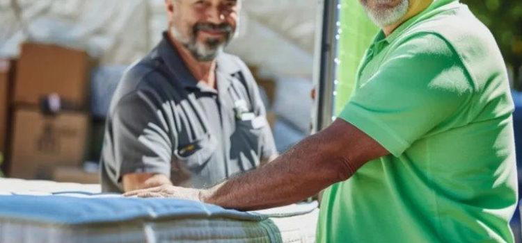
Our Staten Island furniture removal process is quick, professional, and stress free. We do all the heavy lifting for you.
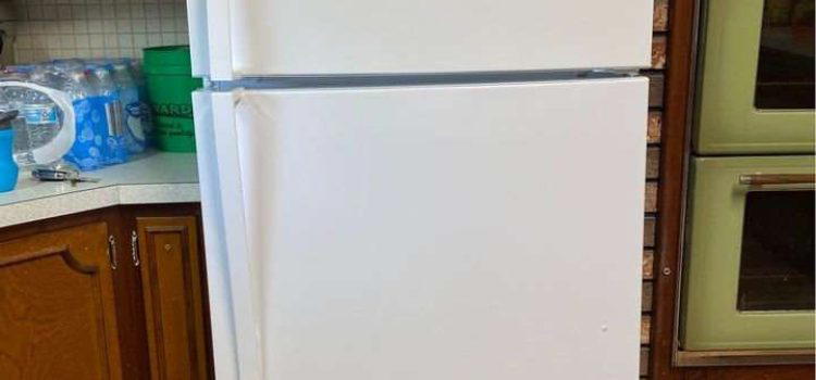
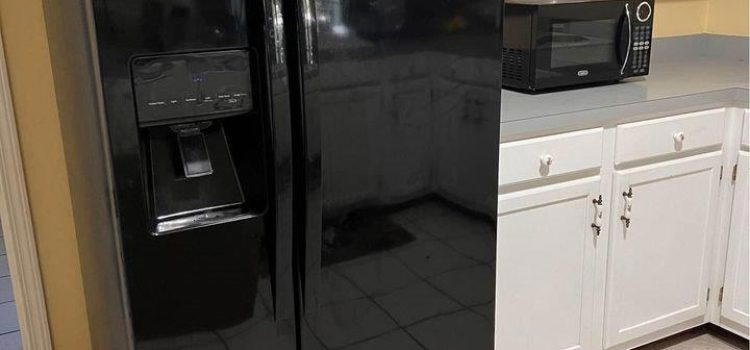
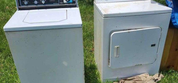
Appliances can range from your cute little countertop toaster to your 6 foot tall, 300lb premium refrigerator. We remove a lot of old appliances in Staten Island, and we’re happy to remove yours too. And it’s important to choose a local disposal service that’s aware of the local laws and regulations. Up to 60% of an appliance can be recycled, and local regulations enforce fines in the case of violations.
But appliances are typically difficult to extract, disassemble, and dangerous to move. Inexperienced movers run the risk of injuring themselves or causing significant damage to building interiors and items. For example, it’s easy to lose control of a refrigerator in transit, and for it to fall on someone or break a precious item.
GO4 Junk Removal provides same day and next day hassle free appliance removal and disposal services to hundreds of happy customers in Staten Island every year. Appliance removal and disposal is a challenging, and sometimes hazardous, task for professionals and amateurs alike – but we make it easy for you! Our staff are experienced, knowledgeable, and properly equipped to remove your appliance safely, without injury or damage. Let us do the heavy lifting.
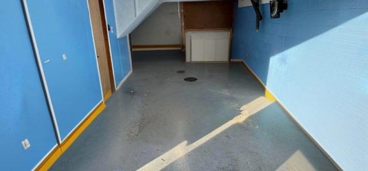
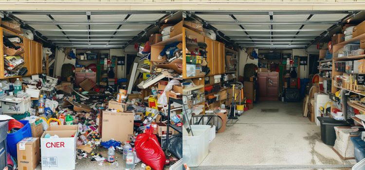
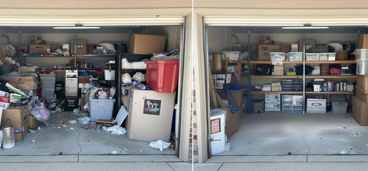
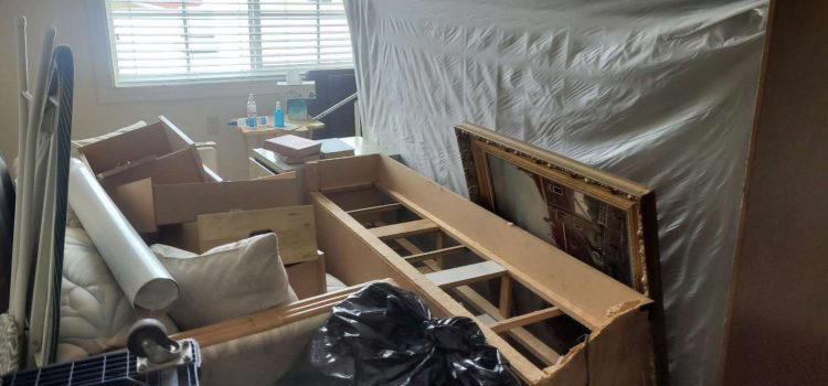
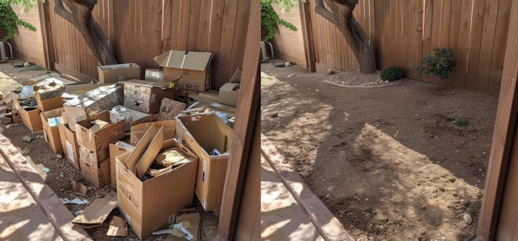
What prompts the need for a property cleanout in Staten Island can vary widely, from the passing of a loved one, moving to a new location, a foreclosure, preparing for a sale, and any number of other cases. There are a lot of variables in cleanouts. The one constant is that they’re extremely challenging, time consuming, and require a great amount of work. It’s easy to underestimate the amount of work involved in sorting, loading, and disposing of accumulated items that comes with Staten Island cleanout. The process can easily become overwhelming, energy-draining and time-consuming.
There are so many reasons why someone might need a cleanout service in Staten Island, but GO4 Junk Removal simplifies everything. All you have to do is tell us what you want to keep, and we’ll set it aside while we remove the rest. With our seasoned crew, we can complete what looks like a week of work in a day or two. We do the lifting, sorting, and disposal, and your property is left swept clean. We’re respectful, organized, and punctual.
Businesses use a lot of materials and produce lots of waste. When your business’s focus is about making a profit, it can be hard to divert resources to cleaning up the place. However, a tidier environment is proven to improve employee mood and work performance. Whether you’re cruising week to week, moving to a new location, or doing on-site modifications, a qualified Staten Island junk hauling service can help keep your site functioning smoothly.
Household items, appliances, yard debris, and more. Whatever items you need removed, the process is fast and easy from start to finish.
Your property in Staten Island deserves to look clean and neat every day. A cluttered or messy yard can dramatically reduce curbside appeal, but even in your backyard it can tremendously reduce your own enjoyment of your home. But the last thing most people want to do on a Saturday is spend hours loading up yard debris and driving all that stuff to the dump. Sweating through your clothes, itchy bug bites, and losing half your weekend isn’t a fun way to spend your only days off.
GO4 Junk Removal provides same day and next day yard waste removal services in Staten Island to hundreds of happy customers every year. Yard waste removal and disposal is a challenging and sometimes unpleasant task – but we make it easy for you! Save your day off for something better. Let GO4 Junk Removal get your yard looking amazing again.
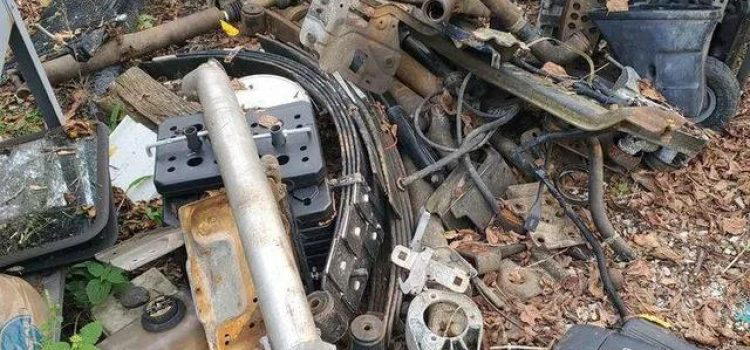
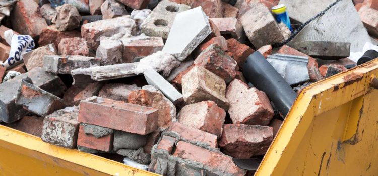
Construction debris can be anything from small items like broken tiles and trim boards all the way to heavy materials like piles of sheetrock, concrete slabs, and discarded lumber. It tends to be heavy, time consuming to remove, and often has special regulations on where it’s disposed of.
GO4 Junk Removal provides comprehensive construction debris removal and disposal services to hundreds of satisfied customers in Staten Island every year. It’s a difficult task that we simplify for you. We have the experience, equipment, and manpower to assess, load, and dispose of construction debris properly. We provide reliable, swift, and effective construction debris removal and disposal services in Staten Island, perfect for projects big or small. No matter the scope of your construction debris removal needs, we make the cleanup easy!
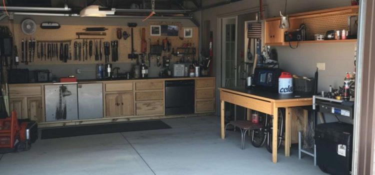
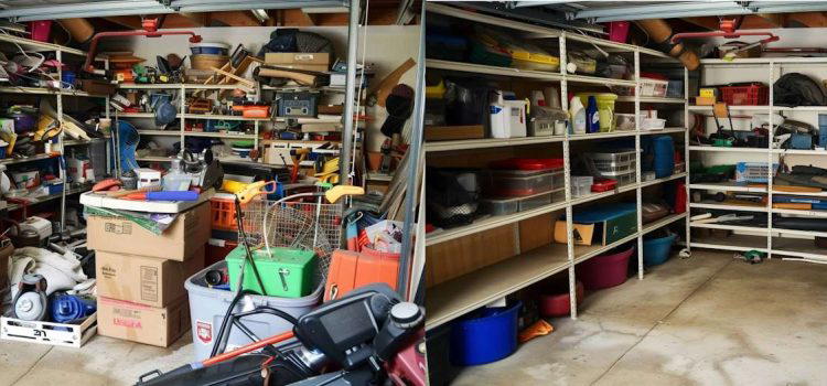
Our household item removal services cover almost everything you could ever want removed from your home that’s not already mentioned elsewhere on our website. Household items can range from small, everyday objects like toys, books, utensils, or clothes all the way to lamps, furniture, storage containers, pots and pans, and so on. This is our catch-all Staten Island junk pickup service that covers everything in your home.
Is your home cluttered with miscellaneous items you haven’t used for years? GO4 Junk removal provides same day and next day hassle-free household item and clutter removal services to hundreds of happy customers a year.
Full service junk removal. Household items, appliances, yard debris, and more. Whatever items you need removed, the process is fast and easy from start to finish.
At GO4 Junk Removal, we handle the heavy lifting for you. Whether it’s old furniture or other bulky items, our team will haul away everything quickly. We focus on recycling as much as possible to cut down on waste. Your removal process will be easy and kind to the environment.
Our residential debris removal services cover many needs. From household junk and yard waste to old appliance disposal, we’re here to help. Whether you’re doing a spring cleaning or need regular clutter removal, just schedule a junk pickup with us. We’ll clear out any room without hassle.
Our commercial junk removal services cater to businesses’ unique needs. We handle everything from office cleanout and retail space clearance to post-construction debris removal. Our services include bulk item removal, making it easy for you to manage large amounts of waste. Let us help keep your business clean and organized with our professional commercial cleanouts.
At GO4 Junk Removal, we are committed to eco-friendly practices. We emphasize recycling to reduce landfill use. Our team follows sustainable methods and uses green practices for environmentally responsible disposal. This helps us contribute to a healthier planet while providing excellent recycling services.
Yes, we do! Our recycling services cover various materials including electronic waste and scrap metal. We make sure everything is processed for proper disposal. By choosing us, you help reduce waste and support a cleaner environment through effective recycling.
We believe in giving back to the community. Whenever possible, we donate items to charitable organizations in the local community. This not only helps those in need but also reduces waste. Our commitment to donation ensures that usable items get a second life, making us a helpful partner in sustainability.
At GO4 Junk Removal, we know your time is valuable. We offer flexible scheduling to fit into your busy life. Our quick response and convenient appointment times make it easy to get the service you need.
Yes! We offer same-day service for urgent junk removal needs. With our flexible appointments, you can check availability and book a convenient time quickly. Our team is ready to respond fast to your requests.
Booking an appointment with us is simple. Use our user-friendly online scheduling tool on our website or give us a call. Our easy process lets you contact us effortlessly and set up your junk removal appointment without hassle.
Flexible scheduling has many benefits:
At GO4 Junk Removal, we believe in honesty. That’s why we offer upfront pricing with no hidden fees. Our competitive rates and clear quotes ensure you know exactly what to expect.
Our pricing is based on several cost factors. When you request an estimate, we consider the size and type of items being removed. This way, we can provide affordable and transparent pricing. You’ll get a detailed quote with competitive rates that reflect the value of our service.
No, there are no hidden fees or extra charges. We ensure full transparency so you understand all costs involved. Our clear pricing model guarantees no unpleasant surprises when you get your bill.
Transparent pricing builds trust and confidence. Knowing the costs upfront lets you make informed decisions without worrying about unexpected expenses. Our honest service and upfront pricing show our commitment to offering value and keeping you satisfied from start to finish.
Our customers often talk about our professionalism and efficiency. “I highly recommend them,” says a happy client, praising our team’s expertise and friendly approach. Many reviews mention our on-time service and focus on client satisfaction. When searching for reliable Staten Island junk removal, read the testimonials from our satisfied customers.
Residents of Staten Island love our flexible and eco-friendly home services. From attic to garage cleanouts, we help clear clutter and make spaces like basements and garages usable again. One resident said, “Our neighborhood is much cleaner thanks to their quick and effective service.” Whether it’s old furniture or general clutter, our residential junk removal in Staten Island is highly recommended for its thorough and environmentally-friendly approach.
Clients choose us for our clear pricing and reliable service. We offer a stress-free and cost-effective way to handle waste disposal in Staten Island. As a local business, we are trusted by the community for our expert services, competitive rates, and professional approach. Selecting GO4 Junk Removal assures an easy experience in managing all types of waste disposal needs.
We serve different businesses including offices, retail stores, restaurants, warehouses, and construction sites. Our commercial junk removal in Staten Island handles property cleanouts and clutter removal efficiently. Businesses can rely on us for quick and reliable commercial junk clearance suited to their needs.
We know that time is crucial for businesses. That’s why we offer same-day service for commercial junk removal. Our team completes large-scale cleanouts quickly and efficiently, with minimal disruption to your work. With confirmed appointments, you can count on us to meet deadlines and handle your business needs professionally and timely.
Handling hazardous materials requires strict adherence to safety standards and regulations. Our trained team ensures the safe disposal of such materials, following all necessary guidelines. While there are limits to what we can remove, we focus on eco-friendly methods and proper handling to keep both our clients and the environment safe in Staten Island.
At GO4 Junk Removal, we offer specialized junk removal services to cover all your needs in Staten Island. Whether you need help with yard waste, construction debris, or estate cleanouts, we handle it all with proper disposal and eco-friendly practices. Our cleaning services are designed to work efficiently, ensuring hassle-free solutions for all your requirements.
Our yard waste removal service makes your backyard cleanup easy and eco-friendly. We take care of landscaping debris, green waste, and other yard waste, recycling everything we can. At GO4 Junk Removal, customer satisfaction is our priority. We use sustainable practices to ensure your yard cleanup is effective and good for the environment.
Construction debris removal can be challenging, but our company makes it efficient and safe. We manage the disposal and recycling of building materials from renovation cleanup and site cleanouts. Operating in Staten Island, our waste management solutions ensure that construction debris is hauled away quickly, leaving your site clean and clutter-free.
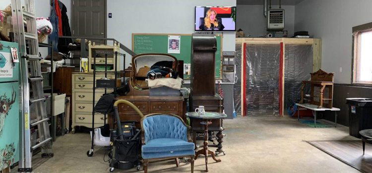
Yes, we specialize in estate cleanout services, offering respectful and timely disposal and recycling. We understand the sensitive nature of handling household items and personal belongings. Our full-service approach covers every aspect of property cleanout, from organizing to disposal, providing a complete solution during probate or any other circumstance.
Booking a service with GO4 Junk Removal is easy and hassle-free. Our online booking system and flexible scheduling options in Staten Island ensure prompt and convenient service. With 24/7 customer support and a no-credit-card policy, we prioritize customer convenience and ease of use.
Our user-friendly website makes online booking a breeze. Simply fill out a short form and you’ll receive instant confirmation of your appointment. This quick process ensures a stress-free way to schedule your junk removal service. Accessibility and ease of use are key features of our online booking system.
Yes, you can call us to schedule an appointment directly. Our customer support team in Staten Island is ready to assist with phone scheduling, offering personalized service and quick response times. Enjoy the flexibility and convenience of direct communication for all your booking needs.
Absolutely, our no-credit-card policy makes booking with GO4 Junk Removal simple and accessible. We aim to build trust and provide assurance with flexible payment options and no upfront cost. Customer-friendly practices define our approach, ensuring ease of use and a hassle-free experience.
At GO4 Junk Removal, we offer great customer service. Our 24/7 support means you can reach us anytime for help or questions. Our team is always ready to assist you.
You can reach our customer service team in many ways. Call us, send an email, or use our online chat. No matter how you connect, our support team is here to help.
We have several support channels to make communication easy. You can contact us by phone, email, or online chat. These options let you reach out and get help 24/7.
Having 24/7 support is good because help is always there. Whether you have emergencies or questions, our team can give immediate assistance anytime.
GO4 Junk Removal supports the Staten Island community. We join local programs and work with charitable groups to give back and support local efforts.
We engage with the Staten Island community by taking part in local events, forming partnerships, and starting various community programs. We’re dedicated to making a positive impact locally.
Yes, we have special programs for charitable organizations. Through donations and other actions, we work closely with nonprofits to support their efforts.
We take several steps to give back to the community. These include supporting local efforts, engaging in charity work, and organizing initiatives that help the Staten Island community. Our goal is to make a meaningful contribution through our support.
Stay updated and connected with GO4 Junk Removal by following our social media channels and signing up for our newsletter. Get the latest updates, news, and promotions.
Follow us on social media platforms like Facebook, Twitter, Instagram, and LinkedIn. Stay informed about our latest updates and community activities.
Sign up for our newsletter to get regular updates. Enter your email to subscribe and stay informed about news, promotions, and important information.
Following us online offers many benefits. You’ll get updates, promotions, and news about our services and community engagements. Stay connected and be part of our growing community.
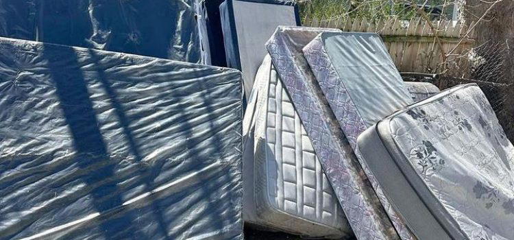
We offer many junk removal services in Staten Island. This includes appliance removal, mattress disposal, construction debris removal, yard waste removal, and estate cleanouts. We also help with hoarder cleanouts, office cleanouts, and other commercial junk removal needs.
Yes, we do. We believe in environmentally responsible junk removal. In Staten Island, we recycle electronics, scrap metal, and other recyclable materials. Our goal is to reduce landfill waste and support sustainable practices.
Yes, we can! We offer efficient furniture removal services in Staten Island. Whether you need to get rid of old couches, beds, or other bulky items, we are here to help.
Scheduling a garbage pickup is simple. Just contact us by phone or through our website. We will arrange a convenient time for your Staten Island garbage pickup. We pride ourselves on being prompt and reliable.
Our Staten Island estate cleanout services are thorough and respectful. We handle belongings with care and clear out the property efficiently, ensuring a stress-free experience for you.
Yes, we do. We offer Staten Island dumpster rental for different needs, like home renovations, construction projects, and large cleanouts. You can choose from various sizes to fit your specific requirements.
Yes, we can remove junk cars in Staten Island. Whether your vehicle is not running or just taking up space, we can handle its removal quickly and efficiently.
Our bulk item removal services help you get rid of large, heavy items that regular trash pickup can’t handle. From hot tubs to pianos, our Staten Island bulk item removal team manages it all.